


Helicopters are scanning powerlines across the CBD and inner suburbs as part of CitiPower’s year-round vegetation management program.
People may see and hear the choppers, which fly about 300 metres above the ground and use technology known as Light Detection and Ranging (LiDAR) to scan the distance between tree branches and powerlines.
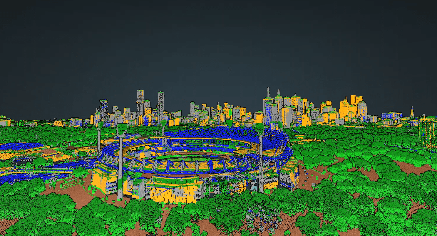
Using the LiDAR data, CitiPower teams create 3D models of powerlines and their surroundings, helping to inform what vegetation needs to be cut.
Head of Vegetation Management, Ayce Cordy, said it was important that accurate measurements were taken of all vegetation each and every year.
“Inspecting and managing vegetation growing near powerlines is an essential part of how we keep power safe and reliable for our customers,” Mr Cordy said.
“By capturing data every year, we can track growth rates of vegetation across our network, helping us plan where to cut right now and when we may need to conduct cutting in the future.”

How our cutting program works
- Our trained cutting teams can enter private property to cut trees back from powerlines, and also work on public land across our network.
- Our teams need to meet clearance requirements that are regulated by Victoria’s energy safety regulator, Energy Safe Victoria (ESV).
- Larger clearance areas are required in areas of higher bushfire risk.
- For private property, our teams notify customers of cutting required at their address, complete the required pruning work then return to remove debris.
- When urgent cutting is identified, we aren’t always able to provide advance notice.
The helicopter fleet
One Bell 407 helicopter
- Crew: One Pilot and one LiDAR System Operator per aircraft
- Top speed: 260km/h
- Range: 870km
- Aircraft length: 12.62m
- Aircraft height: 3.33m
- LiDAR system: RIEGL VUX-240
- Slow cruise speed for LiDAR capture: 129km/h
- LiDAR scan speed: 1.8MHz and 400 lines per second
- Data capture: 1TB per day
Two Bell 505 helicopters
- Crew: One Pilot and one LiDAR System Operator per aircraft
- Top speed: 232km/h
- Range: 617km
- Aircraft length: 12.93m
- Aircraft height: 3.25m
- LiDAR system: RIEGL VUX-240
- Slow cruise speed for LiDAR capture: 129km/h
- LiDAR scan speed: 1.8MHz and 400 lines per second
- Data capture: 1TB per aircraft per day


